The Tale of Two Cities
The ancient city predates written records, so the artifacts and information gathered by ISAS archaeologists are being used to document the lifeways of an ancient native people. Archaeologists call these people the “Mississippians” because they lived primarily in and along the Mississippi River valley. In addition to hunting and fishing, they were farmers, growing early varieties of corn, squash, tobacco, and other native crops. With nothing more than digging sticks, baskets, and axes and hoes with stone blades, the Mississippians turned floodplain forests and prairies into agricultural fields, rural villages, and sprawling urban and ceremonial centers. At urban centers they erected huge ritual marker posts and constructed earthen monuments— some were cemetery mounds, while others were platforms for temples.

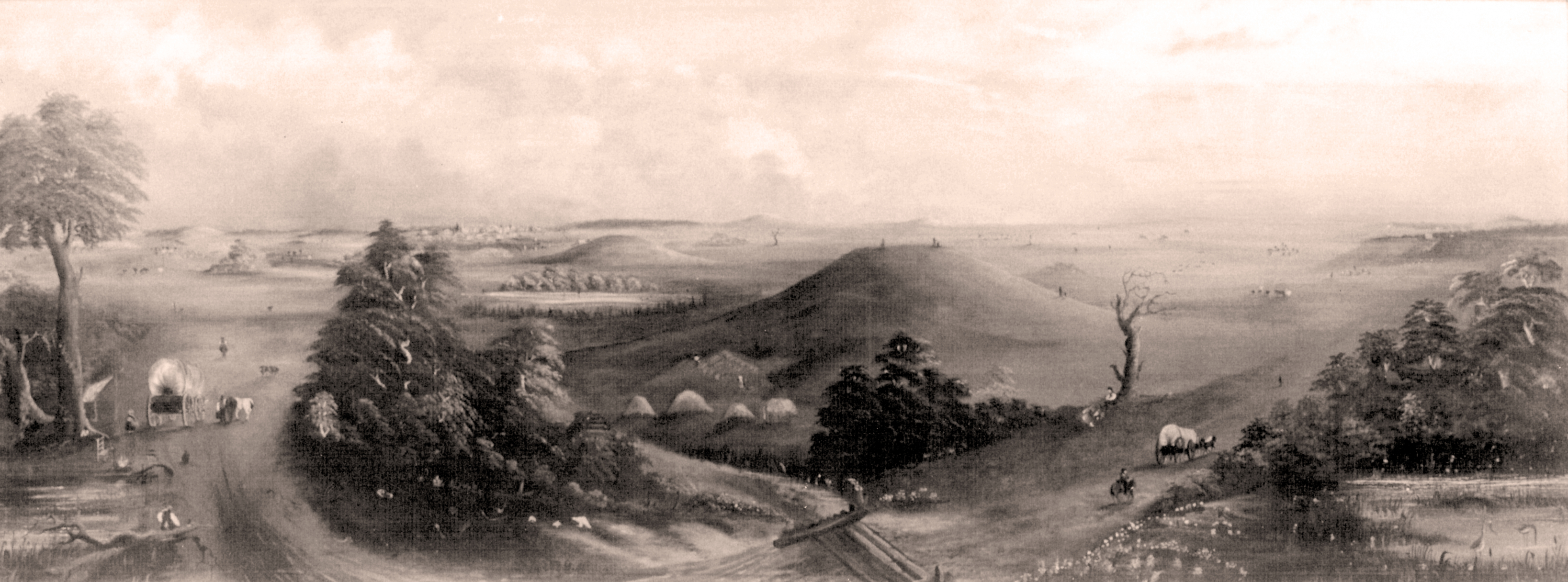
Nineteenth Century Watercolor Painting of the East St. Louis Mound Center [from southwest].
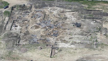
The ancient city of East St. Louis once had an estimated 50 mounds arranged across some 500 acres, and it was home to several thousand residents who lived in pole and thatch houses. In the I-70 alignment, hidden beneath layers of fill, rubble, and concrete foundations from the Euro-American city, ISAS archaeologists excavated more than 6,000 ancient features: house floors, cooking/storage pits, large post pits, and the basal remnants of a mound (Feature 2000). The ancient city of East St. Louis was linked to the nearby Cahokia site by a chain of mounds and villages. The ancient city of Cahokia is preserved today as Cahokia Mounds State Historic Sites and is listed by the United Nations as a World Heritage site.

Aerial View of Archaeological Excavations for relocated Interstate 70 in East St. Louis, Illinois.
In the 1800s, the East St. Louis mounds were leveled and used for fill as the Euro-American city of East St. Louis grew and factories and rail yards expanded. In 1873, the St. Louis National Stockyards opened for business and soon became part of one of the largest meat-packing centers in the world. At its peak, the facility covered 650 acres, employed more than 10,000 workers, and processed 50,000 hogs, 30,000 cattle, 20,000 sheep, and 8,000 calves daily. Nearby neighborhoods housed stockyard workers and local merchants, many of whom emigrated to East St. Louis from the Southern United States and Eastern Europe.
In the 1950s the importance of the stockyards waned, and by 1997, the stockyards closed and neighborhoods were abandoned. In the new alignment of I-70, as it cuts north through the old stockyards and neighborhoods, ISAS archaeologists uncovered and documented several hundred Euro-American residential features including cellars, privies, and cisterns, many of which were filled with household trash: beverage and medicine bottles, dinner plates, children’s toys, and kitchen refuse. These features and artifacts provide new information about the daily lives of early working-class families in East St. Louis.

Artifacts from Excavations: Bone Fish Hook; Stone Arrow Points; Game Dice; Shield Nickel; Rag Doll; Soda Torpedo Bottle; Weiss Bottle, St. Louis.
The goal of archaeology is not simply to collect artifacts but rather to collect information (data) before it is lost. The information is used to build a better understanding of our nation’s collective past. From 2009 to 2012, the ISAS excavations in ESTL employed as many as 100 archaeologists during a single field season. This intensive, large-scale data-recovery effort represents the largest such effort ever undertaken in Illinois and one of the largest in the nation. Nonetheless, only an estimated 10% of the ancient city was investigated for the bridge project. The vast majority of the ancient city falls outside of the I-70 right-of-way and is hidden beneath modern-day East St. Louis.