American Bottom Field Station, Collinsville
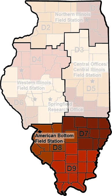 The American Bottom Field Station (ABFS) conducts project surveys and site investigations in IDOT Districts 7, 8, and 9. However, due to sprawling transportation infrastructure in the St. Louis Metro East, most of the work at ABFS is performed within the American Bottom region, the broad Mississippi River floodplain opposite St. Louis, Missouri, which contains abundant and complex archaeological resources.
Erin Benson, Ph.D., Associate Research Scientist and Field Station Coordinator
13 Gateway Drive
Collinsville, IL 62234
618-855-9206
FAP 327/Lebanon Bypass
(IDOT Sequence 12010A-C, ISAS Log 13136, 15035,15195), Funded by IDOT.
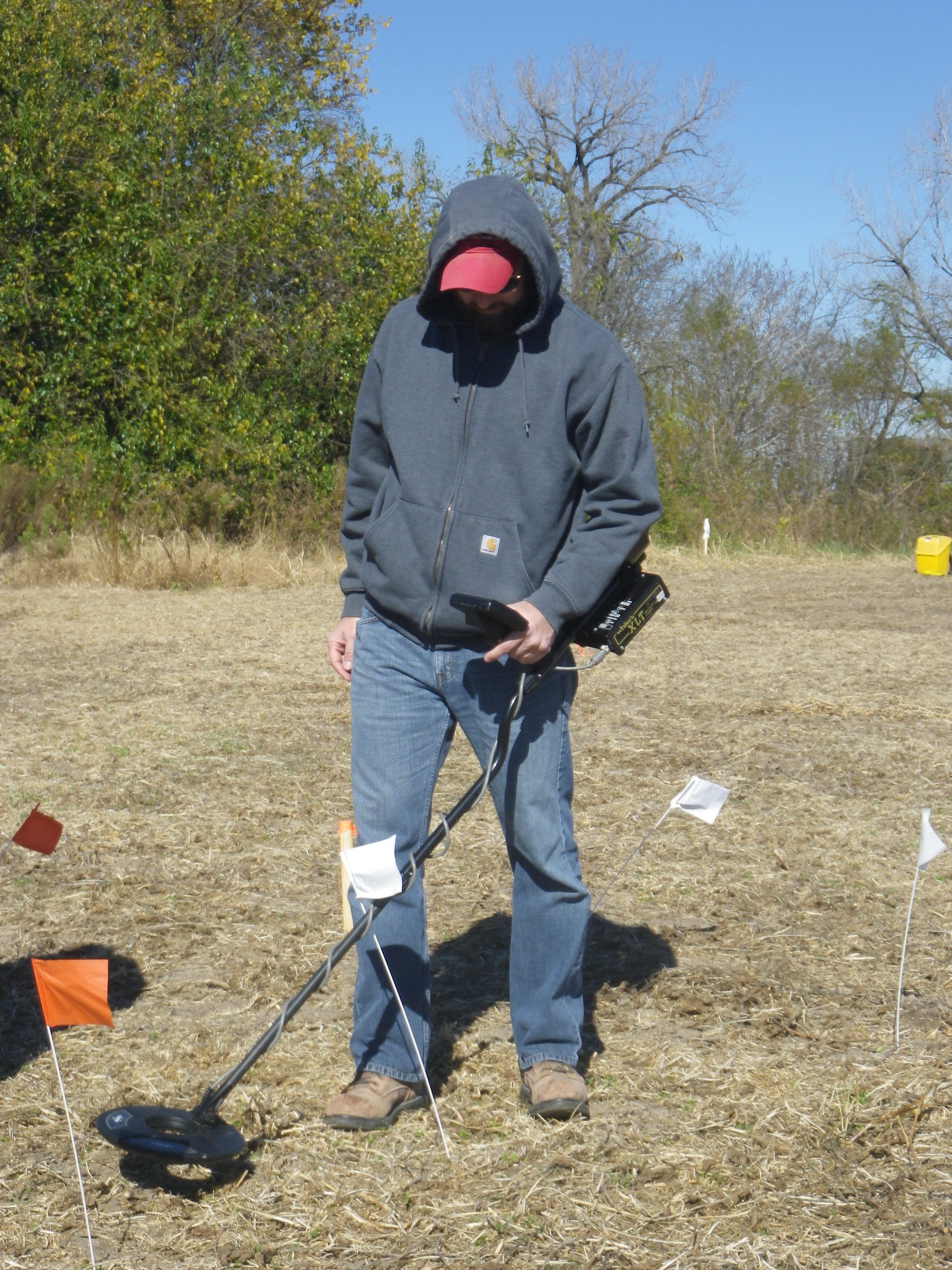 Between 2014 and 2015, ABFS personnel conducted pedestrian, auger, metal detector, and geophysical surveys as well as mechanical testing prior to a proposed highway construction project near Lebanon in St. Clair County. This work resulted in the identification of 7 new archaeological sites (11S2036–2039, 11S2054, 11S2059–2060) and a revisit to 11 previously reported sites (11S731–734, 11S736–737, 11S739, 11S1504, 11S1831, 11S1835–1836). These sites ranged from small prehistoric lithic scatters to nineteenth century Euro American settlements. At least four sites (11S732, 11S736, 11S1836, 11S2060) were determined potentially eligible for the National Register of Historic Places (NRHP) due to the probability for pre-Civil War era historic subsurface features and were recommended for further work.
A.G. Moore Site (11S732)—A pedestrian survey was initially completed at the A. G. Moore site, resulting in the collection of a modest assemblage of historic artifacts. This included refined ceramics (whiteware, ironstone), unrefined ceramics (redware, stoneware, yellowware), container glass, and architectural debris (brick, window glass, iron nails, iron hinges). Both hand painted (sprig) and annular decorations popular ca. 1840–1860 were present on whiteware.
Unrefined ceramics were dominated by salt-glazed and Albany stoneware, with Bristol slip treatments notably absent. Following pedestrian survey, a systematic metal detector survey and magnetometer survey were completed. Each verified the likelihood for historic subsurface features within the project area.
John Wakefield first purchased the land encompassing the site in May of 1832. A. G. Moore acquired the property by the Civil War and a structure is illustrated within the site limits. The Moore family retains ownership well into the twentieth century. The A. G. Moore site is probably associated with the occupation of the property by the Wakefield and Moore families ca. 1832–1900.
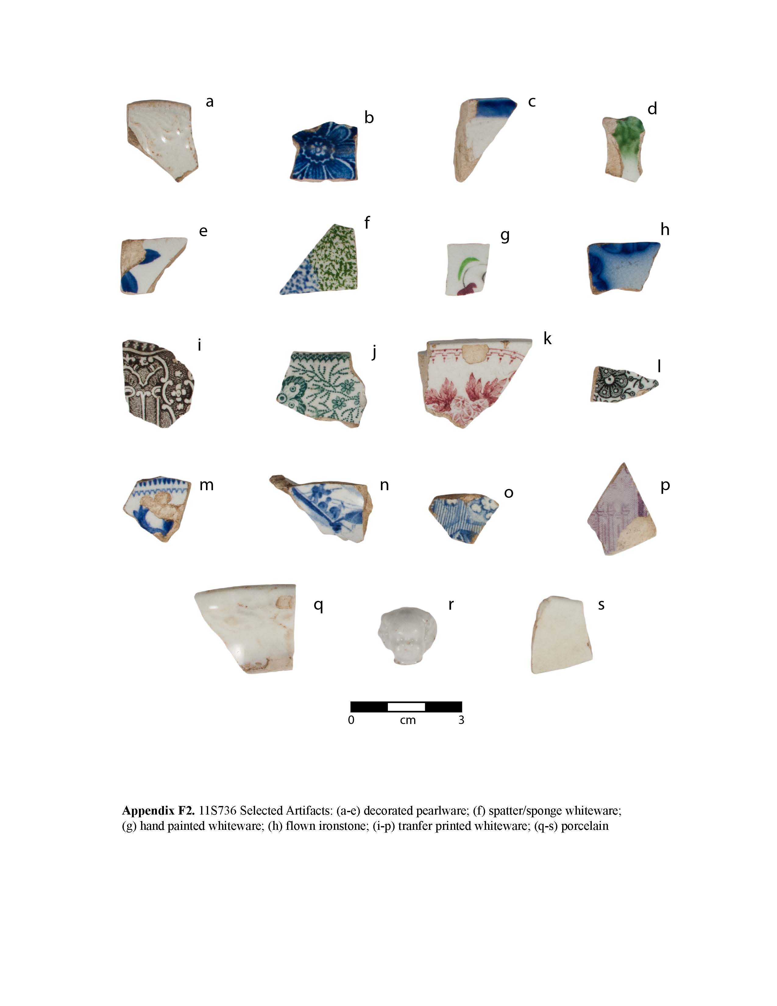 D. Berry Site (11S736)—A pedestrian survey was conducted at the D. Berry site and a sizeable assemblage of mostly nineteenth century historic artifacts was collected. Fifteen prehistoric artifacts were collected including cobbles, chert, rough rock, and fire-cracked rock. Historic material recovered consisted of refined ceramic (porcelain, pearlware, whiteware, ironstone), unrefined ceramic (stoneware, redware, and yellowware), a ceramic marble, container glass, white clay pipe fragments, Prosser buttons, animal bone, and a porcelain doll’s foot. Decorative elements present on pearlware included green and blue scalloped edging and hand painted motifs common during the 1820s. Decorated whiteware consisted of sponged, hand painted, and transfer printed wares common ca. 1830–1860. Decorated ironstone included molded and flown motifs popular ca. 1840-1870s. Architectural debris consisted of window glass, brick fragments, a doorknob, and iron nails.
Thorton Peeples first purchased the surrounding property on August 2, 1831. Possibly through a default on the deed, John McGrew acquired a 40-acre parcel in February of 1837. David Berry purchased the land by the Civil War and a structure is illustrated within the site limits. The D. Berry site is likely affiliated with the ownership of the property by Peeples, McGrew, and Berry ca. 1831–1870s.
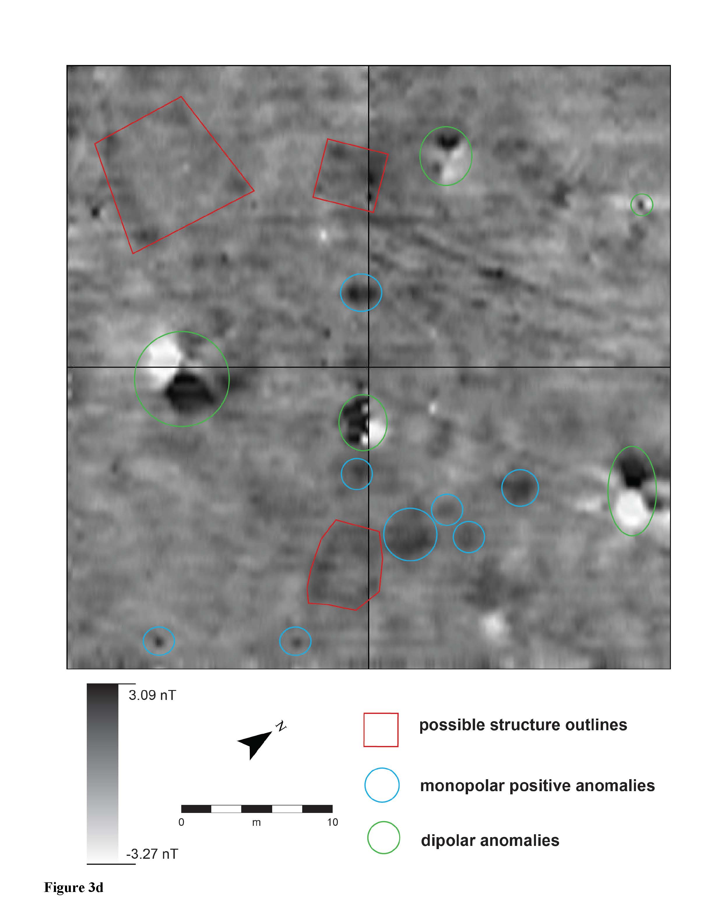 Cirotsih Site (11S1836)—A pedestrian, metal detecting and magnetometer survey were completed at the Cirotsih site, resulting in the recovery of a discrete assemblage of nineteenth century historic material. Artifacts included refined ceramic (creamware, pearlware), unrefined ceramic (redware), metallic buttons (brass, pewter, silver), a silver-plated brooch, pewter pendant fragments, lead shot, and lead scrap. Iron items consisted of chain links, tool fragments, and hand forged nails. Based upon the presence of creamware and pearlware and the general lack of whiteware the assemblage is strongly indicative of occupation pre-dating ca. 1830.
Madeaux Gilless purchased the surrounding property on September 30, 1814. The family of H. H. Horner acquired the land by the 1860s and retained ownership well into the twentieth century. No structures are depicted near this location during the nineteenth century. There is a strong likelihood that the Cirotsih site (11S1836) is affiliated with an early nineteenth century settlement possibly by Madeaux Gilless.
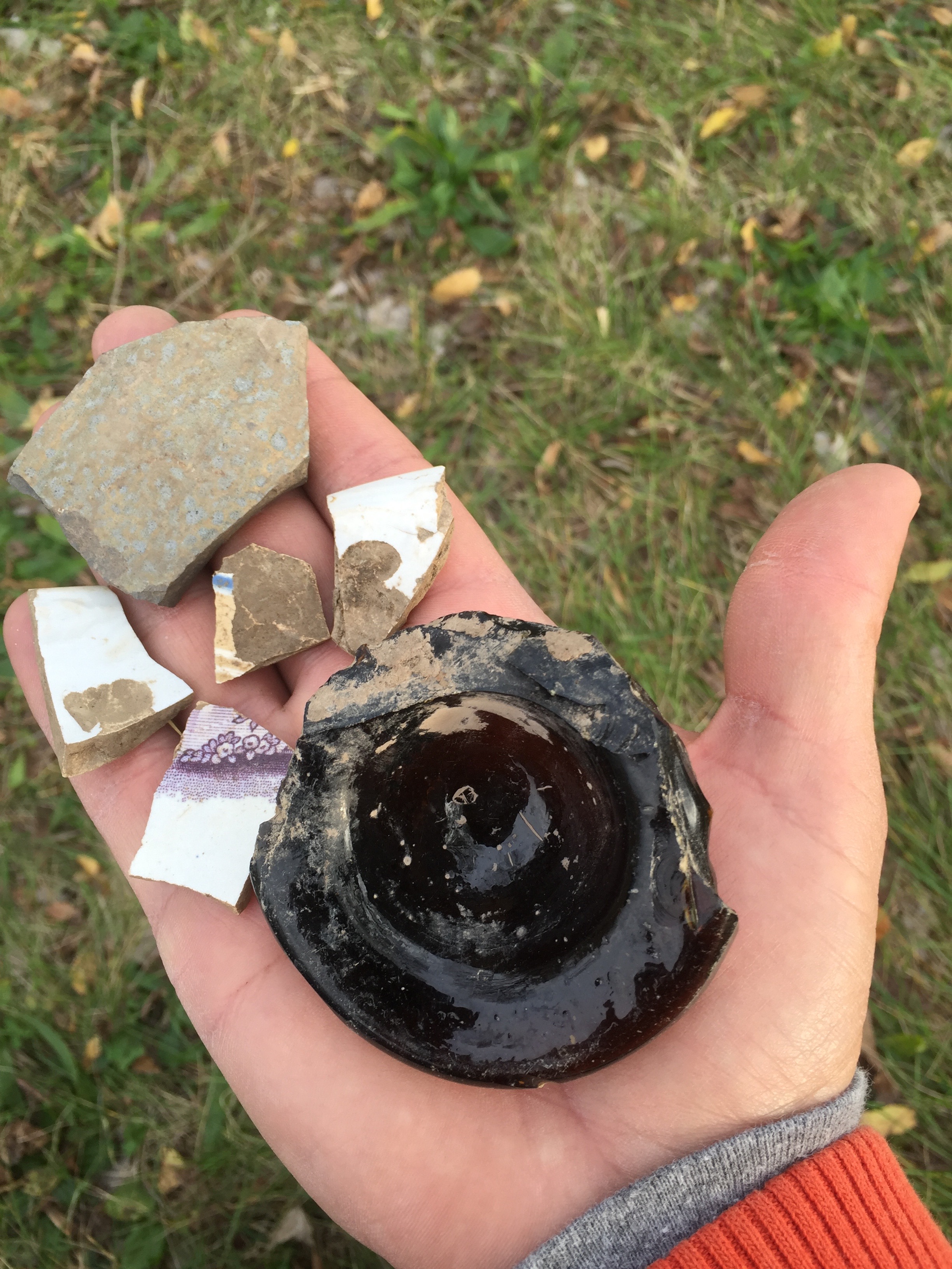 T. Johnson Site (11S2060)—Pedestrian, metal detector, and magnetometer surveys were conducted at the T. Johnson site resulting in the recovery of a sizeable assemblage of nineteenth century historic artifacts. The collection included refined ceramic (whiteware, porcelain, ironstone), unrefined ceramic (redware, yellowware, stoneware), container glass, iron scrap, metallic buttons, lead scrap, lead shot, and architectural debris (brick, limestone, window glass, iron nails). Decorative elements present on whiteware included green edged, hand painted (sprig), transfer printed and annular motifs common ca. 1830–1860. In of September 1831, Cornelius Tinsley purchased the the surrounding property. Thomas Johnson had acquired a small parcel of the land by the Civil War and a structure is depicted within the site limits. Luther Brown was the owner by the 1870s and the structure was no longer present.
Posted 11 May 2016.
Return to top
Rieder Road Project
During 2012, ISAS evaluated nineteen sites in southwestern Illinois potentially impacted by the proposed Rieder Road/I-64 Interchange in St. Clair County. Five of these sites contained subsurface cultural deposits with potential to yield information relevant to the prehistoric and early American occupation of this unique upland locality near Silver Creek. These five sites included remains of storage pits and houses dating to the prehistoric Patrick (A.D. 650-900) and Lohmann (A.D. 1050-1100) phases, and to the Frontier Era (1810-1870) period of American history. Although the periods of occupation are widely separated in time, they share a common theme in that they represent population expansions into this gently rolling landscape of meadowland and tree groves, located adjacent to the floodplains of the two branches of Silver Creek. Nearby, across the stream channels, the famous Looking Glass Prairie at one time stretched to the east as far as the eye could see.
The first substantial occupation of this region of southwestern Illinois occurred during the Patrick phase—a time during which a vibrant Late Woodland society, relying on a highly developed pre-corn agricultural economy, was able to develop a firm foothold in the greater St. Louis bi-state metropolitan area. People lived in large villages and hamlets scattered throughout both the rich alluvial floodplains and the interior uplands. The introduction of corn into the Eastern Woodlands around A.D. 900 permanently and dramatically altered this three-century period of social stability. Local populations underwent significant transformations as a result of the new corn-driven surplus economy, which eventually enabled powerful and enterprising leaders during early Mississippian age times (A.D. 1050-1200) to finance the construction of large architectural undertakings at the only true prehistoric city north of Mexico—at the prominent nearby floodplain site of Cahokia. As Mississippi floodplain acreage became increasingly valuable, however, it was necessary to resettle whole villages from the valuable floodplain soils into the nearby upland regions. One of these areas of resettlement was the Silver Creek locality which saw a substantial population influx during Lohmann phase times. The displaced floodplain farmers were forced to rely on the more restricted, but still productive, floodplain soils associated with the smaller upland stream channels for growing corn. This upland experiment seemed to thrive for a short period of time, but was eventually cut short about A.D. 1250, possibly as a result of an extended period of drought.
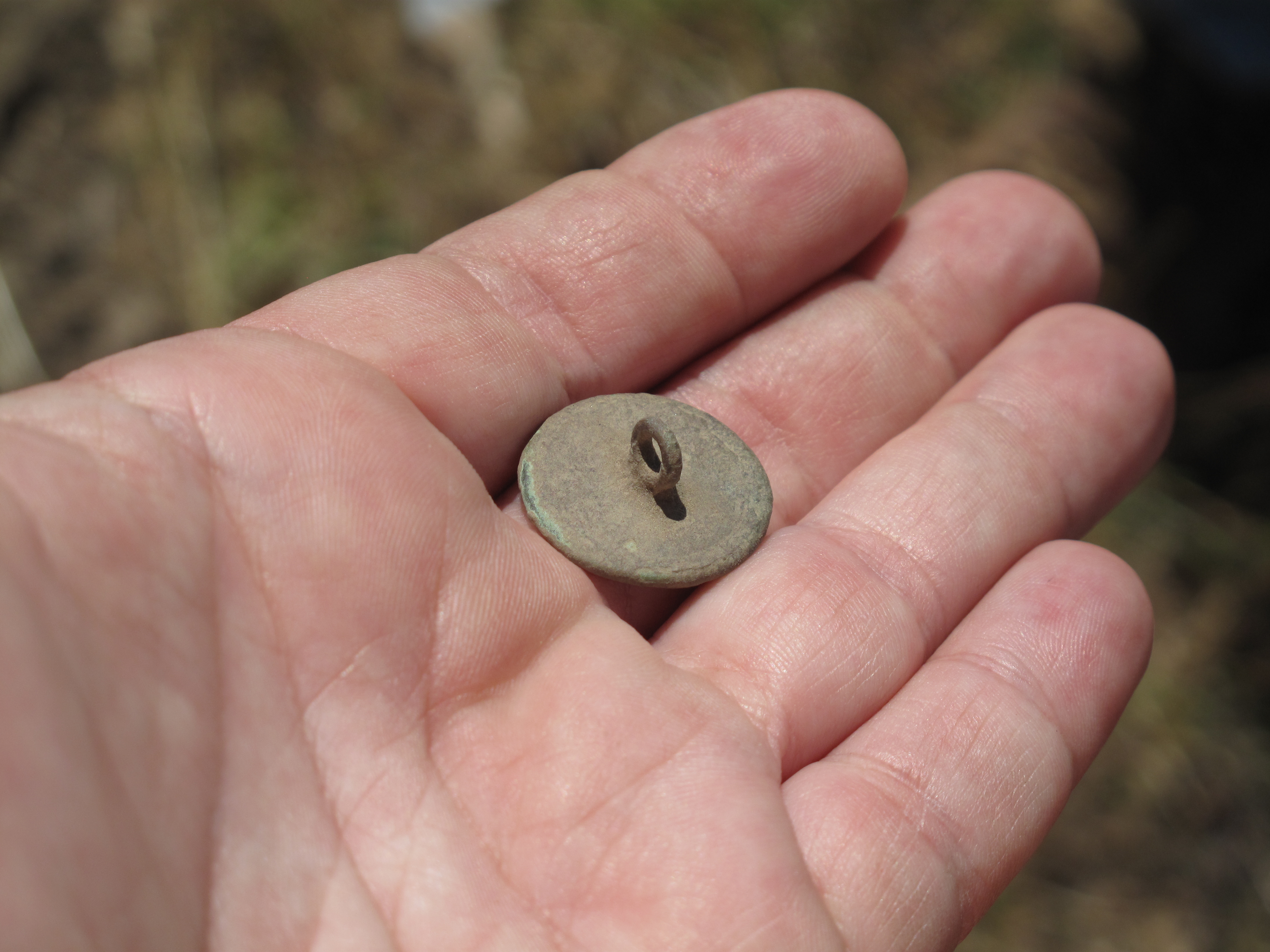
The early historic American immigrants arrived in this same region following the War of 1812, and not surprisingly, faced similar challenges as their prehistoric counterparts. The early settlers were seeking land to grow both the Old World crops that they were familiar with, like wheat, oats, and barley, but also the indigenous crop of corn, which they eagerly adopted. They sought to build on land that was not frequently flooded like that of the nearby Mississippi River floodplain, and were particularly interested in the open meadowlands of the Silver Creek drainage. They were able to pasture cows, and the abundant tree groves provided construction material for houses, barns, corrals, and pigpens, and served as a ready source for heating fuel. We hope that our investigations will eventually shed light on the unique role this region played in the development of Cahokia, and in the period of American Frontier expansion.
Return to top
Gypsy Rose Lee (11MS2410)
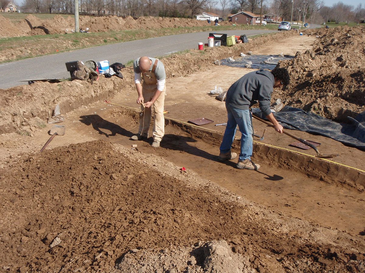 The Gypsy Rose Lee site (11MS2410) was discovered in March 2013 during an archaeological survey associated with scheduled IDOT improvements to Spring Valley Road in southern Madison County. The site is located in the uplands on the Silver Creek drainage, roughly 15 km northeast of Cahokia. Numerous pieces of chert debitage, rough rock, and ceramic sherds were recovered within the project’s proposed right of way; the latter included several Early Mississippian and two Late Woodland cord-marked sherds. Mechanical removal of the plow zone revealed 29 Early Mississippian Lohmann phase (A.D. 1050–1100) cultural features, including four wall-trench structures, three interior pits, 21 exterior pits, and one hearth. All features that fell within the project ROW were completely excavated.
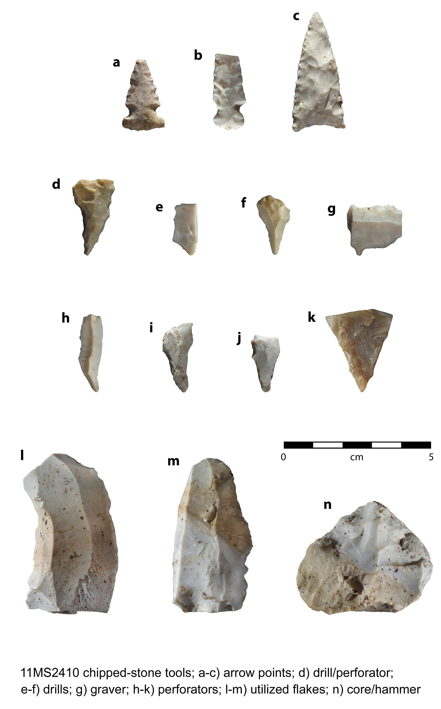
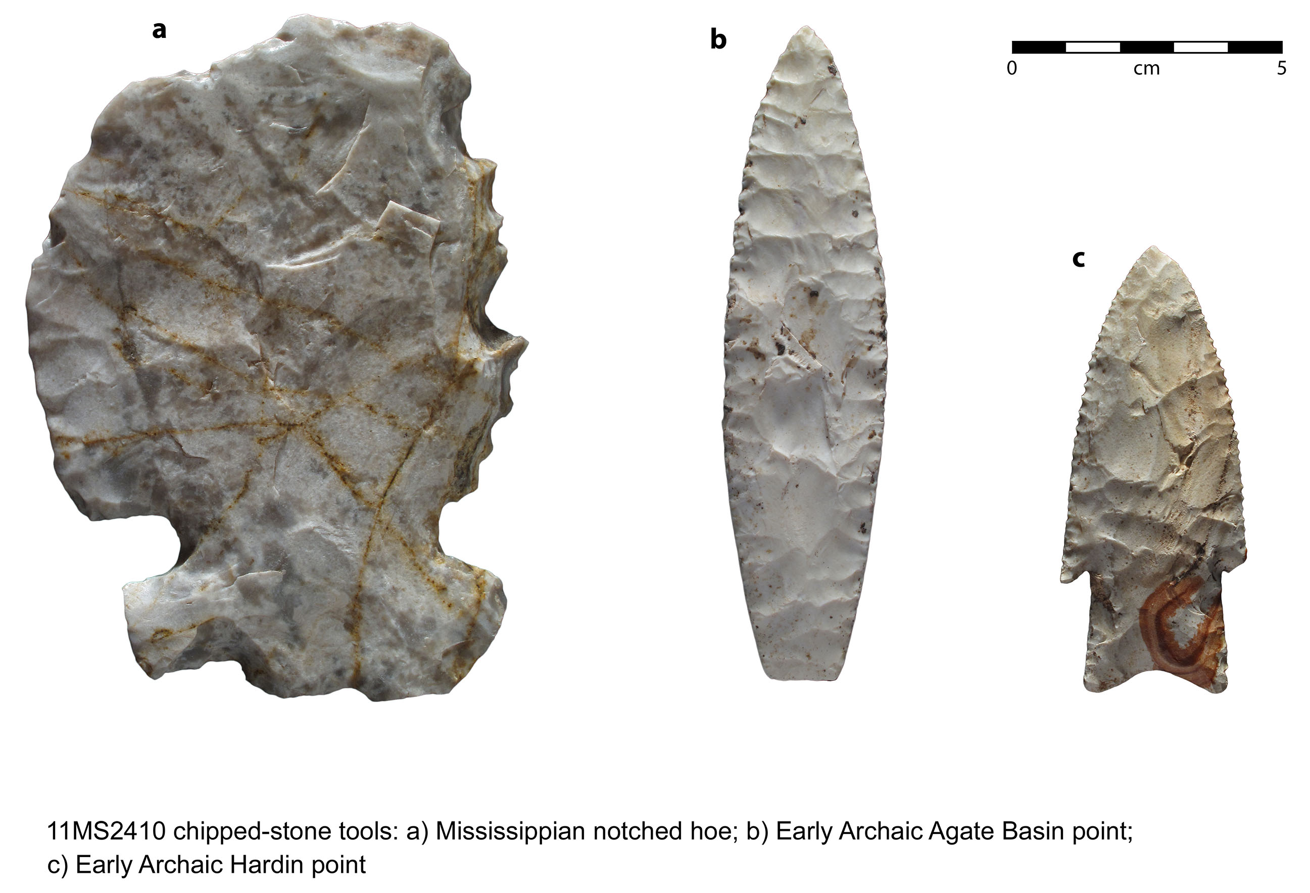
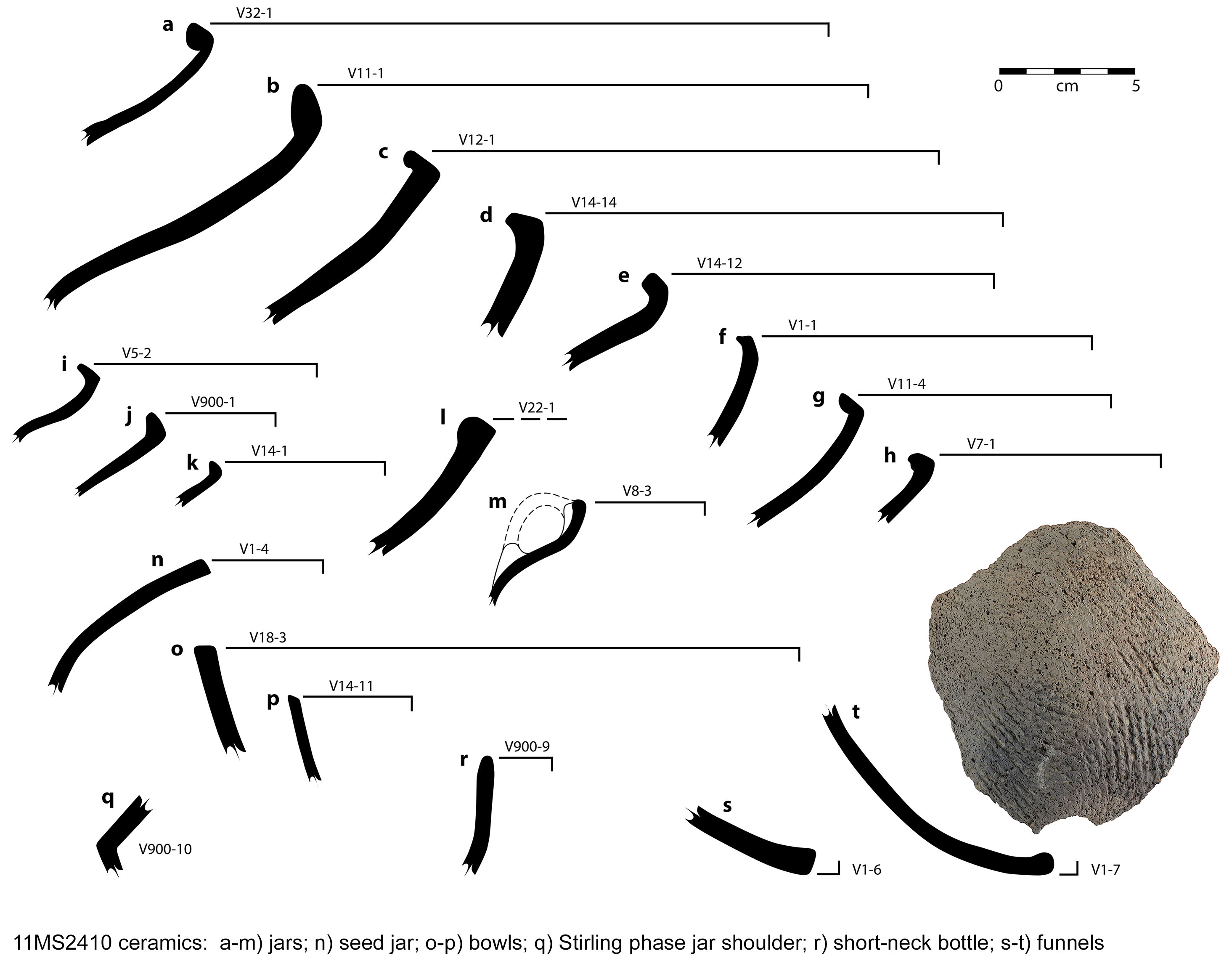
Material recovered during site excavations is comprised of ceramic, lithic, and botanical material. Ceramics are consistent with Lohmann assemblages in the American Bottom, with jars dominating the assemblage and bowls, funnels, and bottles accounting for the minority. Lithics from the site are also consistent with Lohmann assemblages but reflect activities and status generally associated with sites in the American Bottom near Cahokia rather than those in the uplands and include numerous microliths, drills, and perforators, tools that are generally associated with shell bead production. Status or exotic items recovered at Gypsy Rose Lee consist of galena, a Cahokia-style discoidal, and non-local Kaolin chert tools and debris that account for roughly ten percent of the chipped stone assemblage. In addition to the Mississippian lithics, two Early Archaic projectile points or knives— Agate Basin and Hardin Barbed — were recovered from the plow zone. Botanical remains were recovered from 27 features and include corn, squash, starchy seeds, and nutshell; hickory, oak, and elm were utilized for fuel.
Our investigations and subsequent analysis of cultural materials determined that the site was predominately occupied during the Mississippian Lohmann phase. Artifacts indicative of other time periods such as the Early Archaic points, Late Woodland body sherds, and one Stirling phase Ramey Incised sherd, either represent prehistorically “found/collected” items or ephemeral earlier and later occupations of the site. The lack of long-term occupation immediately prior to the Lohmann phase settlement at Gypsy Rose Lee is consistent with the overall pattern of resettled founder populations in the uplands at the onset of the Mississippian period. The site differs however from other contemporaneous upland settlements in that some level of crafting occurred at the site and numerous status and exotic lithic materials were present. ISAS Log #13023
Our investigations and subsequent analysis of cultural materials determined that the site was predominately occupied during the Mississippian Lohmann phase. Artifacts indicative of other time periods such as the Early Archaic points, Late Woodland body sherds, and one Stirling phase Ramey Incised sherd, either represent prehistorically “found/collected” items or ephemeral earlier and later occupations of the site. The lack of long-term occupation immediately prior to the Lohmann phase settlement at Gypsy Rose Lee is consistent with the overall pattern of resettled founder populations in the uplands at the onset of the Mississippian period. The site differs however from other contemporaneous upland settlements in that some level of crafting occurred at the site and numerous status and exotic lithic materials were present. ISAS Log #13023
Return to top
Janey B. Goode (11S1232)
Data recovery began in 2002 at the dense, complex Janey B. Goode (“JBG”) site (11S1232), a 6 ha occupation along the southern margin the Horseshoe Lake meander just north of the East St. Louis Mound Group (11S706). The site abuts an active railroad yard, and is capped by ~0.5 to 1.5 meter layers of historic railroad debris and fill. By the end of the 2003 field season, approximately 22 percent of the site was stripped and nearly 2,200 prehistoric features have been excavated.
To date, the largest occupations at JBG are from the Late Woodland Patrick phase and early Terminal Late Woodland Loyd phase. Also present are more widely scattered late Terminal Late Woodland (Merrell or Edelhardt phase), Stirling phase, and late Moorehead or Sand Prairie phase Mississippian features. Numerous single-post and wall-trench structures have been excavated. Pit features are abundant and diverse, and several large post pits with extraction ramps have also been excavated. One of the more interesting and puzzling discoveries of the 2003 season is a linear ditch-like feature about 2 m wide and 50–70 cm deep (Figure 6). A 30-m long segment of the ditch has been excavated, with no evidence for internal or external posts. Its end points have yet to be uncovered. It extends northward from an old Cahokia Creek meander and exhibits multiple episodes of siltation and prehistoric re-excavation (maintenance). Possibly used for drainage and/or defense, the ditch fill is laminated, suggesting that it frequently held water. Superimposition of this ditch by Loyd phase pit features indicates an association with JBG’s earliest occupations. On the western flank of the site, a swale approximately 75 m long, 20–25 m wide and up to 2.5 m deep appears to have been deliberately filled. Most of this landscape modification was apparently performed during the Terminal Late Woodland occupations. The ditch construction and the swale filling required substantial labor investments, hinting at a previously unrecognized level of social complexity during the Terminal Late Woodland period in this area of the American Bottom.
The preservation of faunal and floral remains at JBG is excellent due to a general abundance of limestone within the features. Features with large quantities of fish bones, scales and mussel shell (some modified into artifacts) reflect the site’s location near aquatic resources. Bone artifacts, especially awls, pins, and fish hooks are common, and several features produced unusually well-preserved plant materials, including charred cordage. Also, it appears that the inhabitants of JBG were involved in extraregional interaction throughout its occupation. A Stirling phase pit excavated in 2002 yielded 36 intact conch and whelk shells, a bison scapula, and two-dozen Marginella shells (Figure 7). Other features produced marine shell disc beads and pendants, Marginella beads, shark teeth, copper, nonlocal and/or unusual ceramic vessels, and worked quartz, galena, hematite, and basalt.
Investigations at Janey B. Goode will make a significant contribution to our knowledge of Late Woodland to Mississippian populations occupying the area of the East St. Louis Mound Center vicinity. Up to this date, very little has been known about the occupation of this area, particularly during the Late Woodland.
Return to top