Mississippians After Cahokia
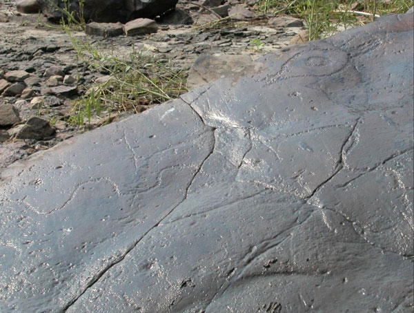 Somewhere around the year 1300, along a short narrow stretch of the Mississippi River strewn with great boulders at the southern end of Illinois, Native peoples travelling the river pecked a simple map onto a rock jutting out from the shore. It showed the river and a series of places, trails, and glyphs of a thunderbird, a moccasin, arrows, and more. They lived in a time of great change. To the north, the city of Cahokia had been left behind, and new “Mississippian” provinces were arising to the south.
ISAS archaeologists are at the forefront of research on these Mississippians, from southern Illinois and Indiana down to northwestern Mississippi. In some places, the Indigenous towns that followed Cahokia were packed with people, protected by palisade walls, and sometimes burned to the ground. Who controlled the Illinois River valley, the lower Ohio, and the main stem of the Mississippi, and how did they do it? Who sought to continue the ceremonial practices first introduced at Cahokia, and who did not? How did maize play an even bigger role than it had earlier, even as the climate turned colder and, in places, drier? How fast did this all happen, and was it related to climate changes centuries ago?
Research is planned or ongoing at sites from South Cape Girardeau, Missouri, to the middle of the Illinois valley near Peoria, Illinois, and up the Ohio River. ISAS archaeologists use geophysics—high-tech magnetometers and electromagnetic induction devices—to see the building walls and storage pits of the pre-contact settlements. Excavations are sometimes necessary just to save what remains of settlements threatened by modern farming practices and capital developments.
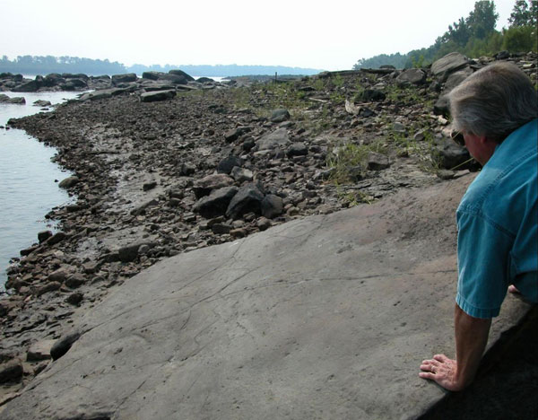
Map boulder with view of Mississippi River
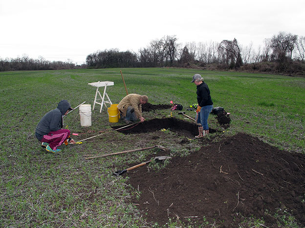
Collaborators from the Illinois State Archaeological Survey, Southeast Missouri State University, and Southern Illinois University Carbondale conduct test-excavations on a possible late Mississippian (AD 1300–1450) house identified in a geophysical survey in southeast Missouri.
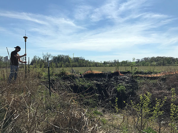
Illinois State Archaeological Survey crew map the outlines of a large sinkhole that threatens an archaeological site in southeast Missouri.